Real‑Estate / Property Shoots
A showcase of aerial photos, videos, and 3‑D tours we’ve produced for Colorado real‑estate developers, agents, and property managers. Each carousel slide will eventually have its own short description and a link to the full gallery.
Project Name – Coming Soon
Short description of the project (replace with real copy later).

Project Name – Coming Soon
Short description of the project (replace with real copy later).
Digital Development
Custom mobile and web applications built to solve real problems for our clients. From interactive trail maps with live conditions to GPS‑enabled outdoor tools, Alpine Geospatial designs, develops, and ships production‑ready digital products.
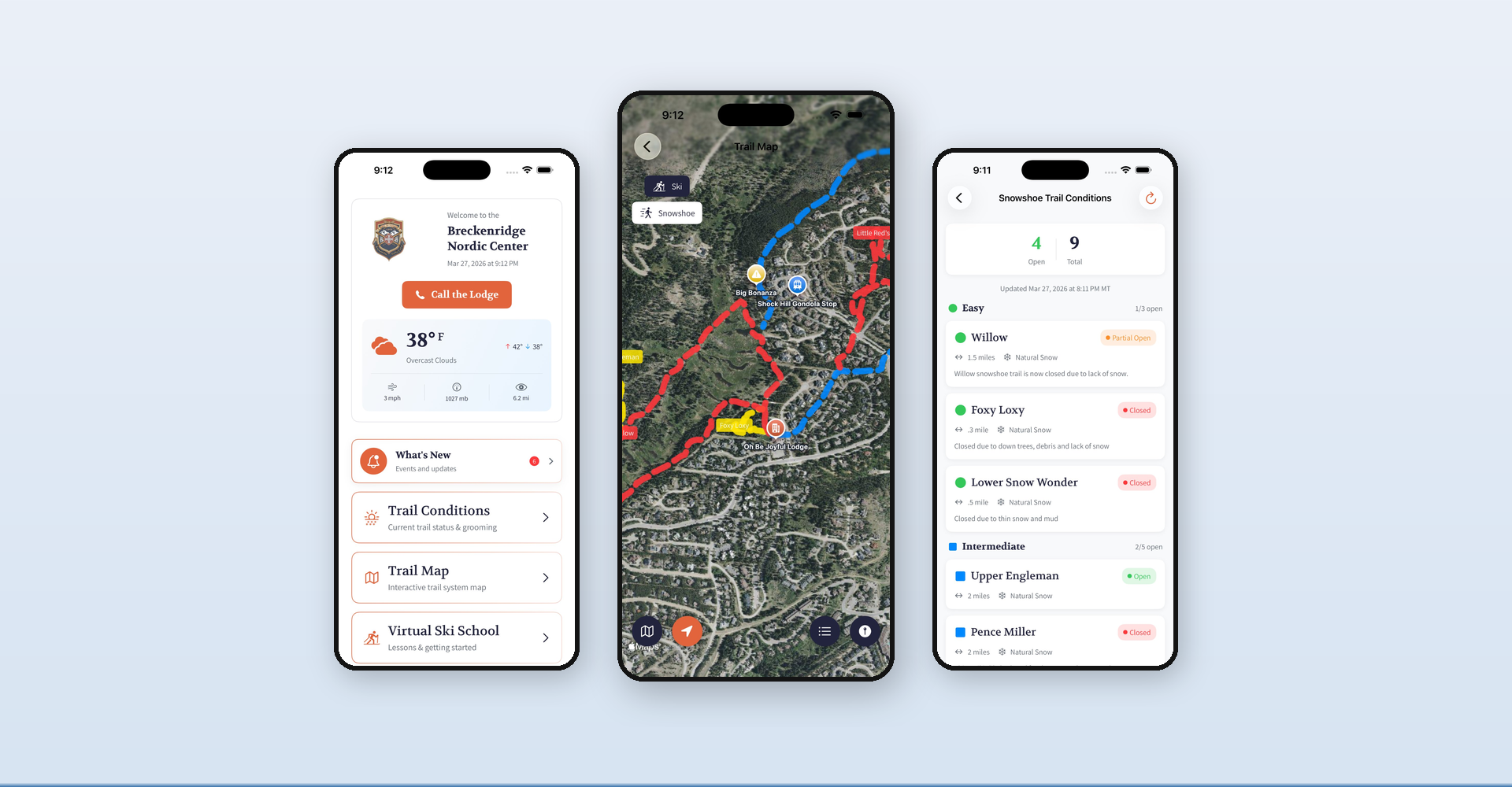
GoBNC – Breckenridge Nordic Center App
The official iOS app for the Breckenridge Nordic Center. Built by Alpine Geospatial, GoBNC gives visitors live weather and trail conditions, an interactive GPS satellite trail map with color‑coded ski and snowshoe routes, a virtual ski school with video lessons, and real‑time news and event updates — all in one pocket‑sized guide.
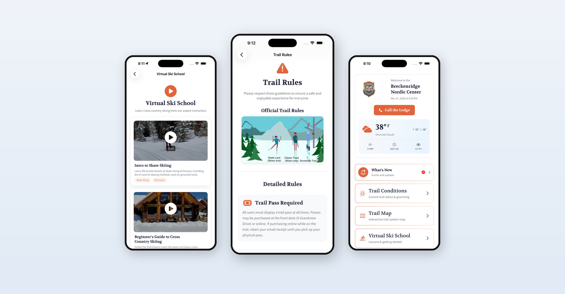
GoBNC – Live Conditions & Ski School
Daily‑updated conditions for 13 ski and 9 snowshoe trails — each with open/closed status, snow type, distance, and grooming notes. The built‑in Virtual Ski School offers expert video lessons on skate skiing, classic technique, and more for every skill level.
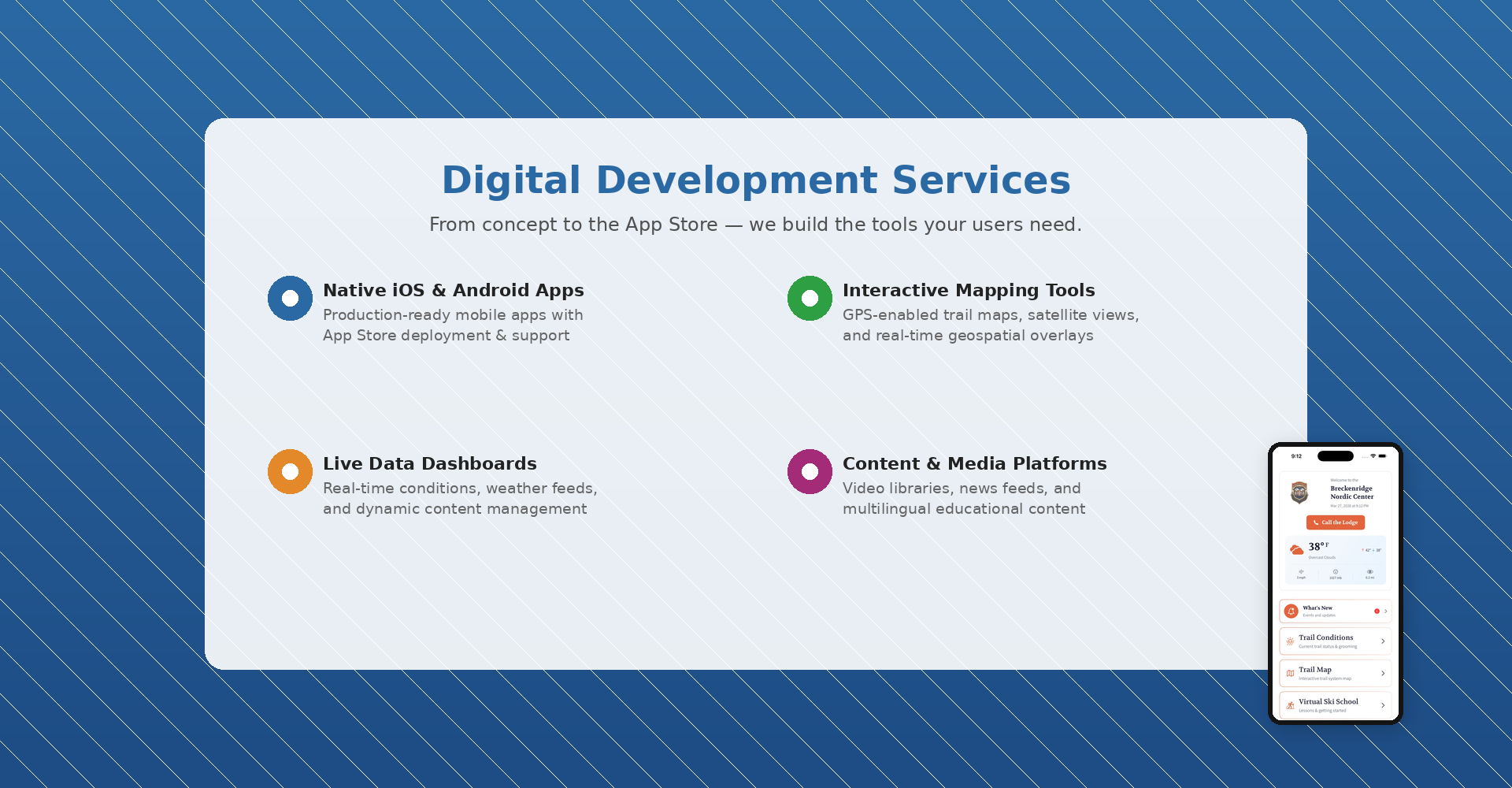
Our Digital Development Services
We build native iOS/Android apps, responsive web applications, and interactive mapping tools. Whether you need live data dashboards, GPS‑enabled field apps, or customer‑facing mobile experiences, Alpine Geospatial can take your project from concept to the App Store.
Consulting – Drone‑Based Services for Colorado Entities
Alpine Geospatial is preparing a consulting program to help municipalities, state agencies, and private organisations launch their own drone‑inspection and data‑collection services. This carousel will showcase case studies, service packages, and products once the program is live.
AI‑Enabled Land Management & Wildfire Risk Analysis
Alpine Geospatial is researching the use of large language models, vision‑language models, sensor‑fusion, and machine‑learning pipelines to predict wildfire behaviour, assess fuel loads, and recommend mitigation strategies. When the research matures into a product, this carousel will host demos, papers, and downloadable tools.